NATURAL DISASTERS
EARTHQUAKES
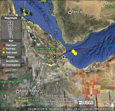 | Magnitude: 4.9 Location: Divergent Date: Friday, October 21, 2011 Time: 23:19:14 Depth: 10.00 km (6.21 mi) Tectonic plate boundary: divergent Why this boundary: The Red sea is located here, which must mean the plates are moving apart. |
  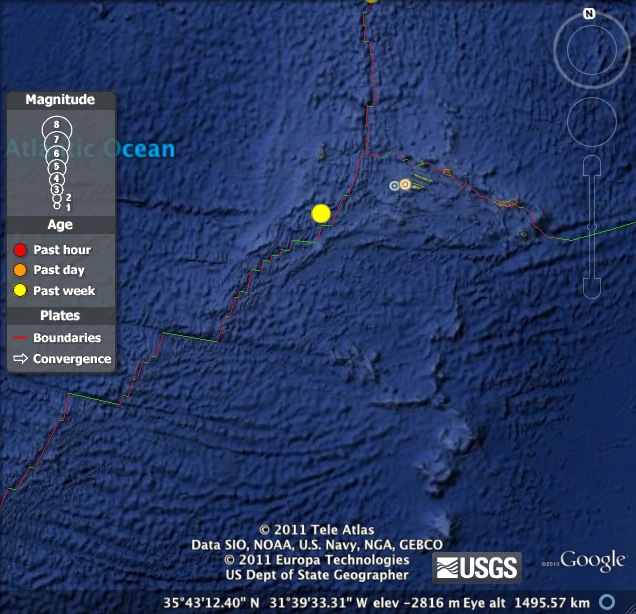
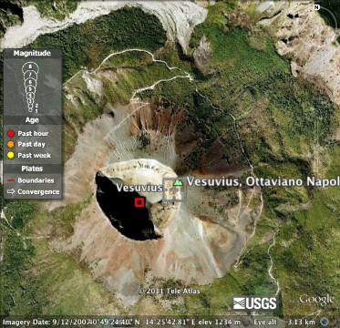
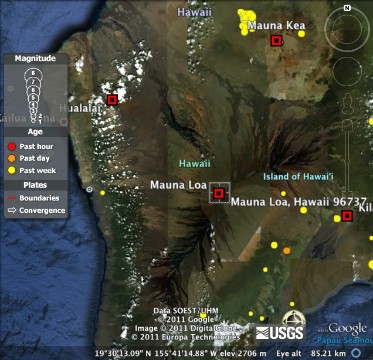
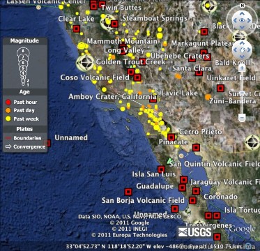
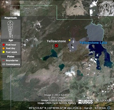
VOLCANOES Volcano name: Mt. Vesuvius, Italy Type: composite Tectonic Plate Boundary: divergent Volcano name: Mauna Loa, Hawai'i Type: shield Tectonic Plate Boundary: oceanic-oceanic Volcano name: Amboy Crater, California Type: cinder cone Tectonic Plate Boundary: oceanic-continental Volcano name: Yellowstone Type: caldera Tectonic Plate Boundary: hot spot | Magnitude: 4.6 Location: Salta, Argentina Date: Monday, October 24, 2011 Time: 22:41:52 Depth: 96.40 km (59.90 mi) Tectonic plate boundary: oceanic-continental Why this boundary: The Pacific Ocean meets the South American Coast Magnitude: 4.0 Location: San Francisco Bay area, CA Date: Thursday, October 20, 2011 Time: 21:41:04 Depth: 8.10 km (5.03 mi) Tectonic plate boundary: transform Why this boundary: There are many small earthquakes over a wide range in this area, which must mean the two plates must be sliding past each other. Magnitude: 7.2 Location: Eastern Turkey Date: Sunday, October 23, 2011 Time: 10:41:21 Depth: 20.00 km (12:43 mi) Tectonic plate boundary: continental-continental Why this boundary: The two plates of land seem to push together to create hills and mountains in that area. Magnitude: 4.9 Location: Azores Islands region Date: Wednesday, October 19, 2011 Time: 06:23:43 Depth: 12.20 km (7.58 mi) Tectonic plate boundary: oceanic-oceanic Why this boundary: It is in the middle of the Atlantic Ocean, right next to an underwater ridge.
    |
ePortfolio Assignment Reflection
The Theory of Plate Tectonics states that Earth is an active planet, meaning that it is constantly in motion. The surface is composed of plates that move and change the earth’s surface. During this interaction of the earth’s different plates, earthquakes are volcanoes are formed and triggered by the movement.
The Theory of Plate Tectonics allows us to have a better understanding of what areas around the world are more vulnerable to volcanoes and earthquakes, according to their spatial relationship with the plate boundaries. We know that both of these natural disasters occur more often in and around the places where plates meet. This knowledge allows us to be more prepared for earthquakes and volcanoes.
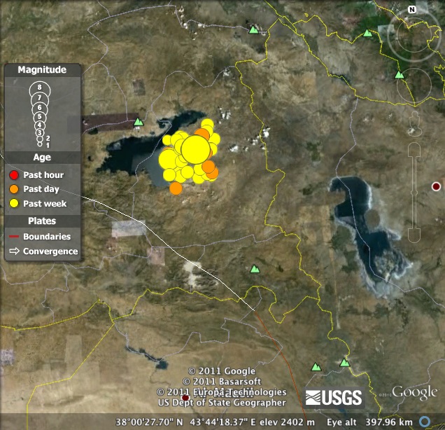
During this semester, I have learned a lot of good information about different types of natural disasters; earthquakes and volcanoes are two of the ones we have focused on and I have definitely learned some new and interesting things. For example, I was completely unaware of how many earthquakes happen around the world everyday. I saw this while looking at the Google Earth images of earthquake tracking. There were about ten small earthquakes in the same area, all within a couple days of each other; that was very surprising for me. Another thing I learned that was new to me was how many different types of volcanoes exist. I didn’t know about caldera, shield, etc. That was a really interesting thing for me to learn about, and having an interactive assignment like this one was a fun and exciting way to do so.
This has extremely shifted my worldview about natural disasters. Now that I can see and understand these concepts better from a scientific aspect, I am a little surprised at the lack of preparedness that we generally have across the world. Many people die in major natural disasters and there are a lot of large cities in the areas that are extremely vulnerable to them. With all the information that we possess, I feel like it is something that we can control a lot better than we do currently.